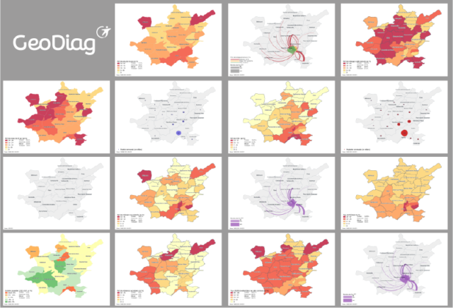
GeoDiag is an exclusive Transdev tool, which allows you to produce, in just a few clicks, 30 socio-eco-demographic maps on the territory of your choice. This set of maps is based on the cross-referencing of data from Insee, IGN, SNCF or National Education.
Their analysis makes it possible to appropriate a local area very quickly and to know its main characteristics.