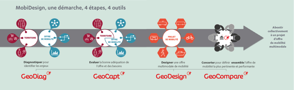
Design of
the mobility
offer with MobiDesign

![]() What is it?
What is it?
GeoDiag is an exclusive Transdev tool, which allows you to produce, in just a few clicks, 30 socio-eco-demographic maps on the territory of your choice. This set of maps is based on the cross-referencing of data from Insee, IGN, SNCF or National Education.
![]() What is it?
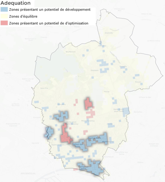
What is it?
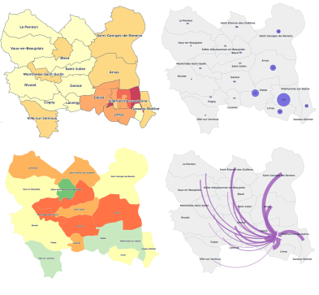
GeoCapt is an exclusive Transdev tool, which makes it possible to identify, in a mapped manner, the areas in which to intervene as a priority, with the aim of ensuring equitable service throughout the region. The areas with a good match between supply and demand and those, on the contrary, with under- or over-supply, which can be improved, are highlighted.
![]() What is it?
What is it?
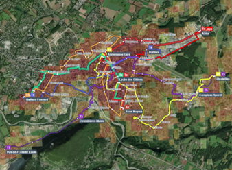
GeoDesign is an exclusive Transdev tool, which makes it possible to design new bus lines, position VLS stations, bicycle parking or carpooling areas thanks to numerous decision-making aid data. We can directly measure the impact of these changes on the population as well as the cost of operating the network. GeoDesign allows you to quickly test different mobility scenarios and choose the most relevant hypothesis.
![]() What is it?
What is it?
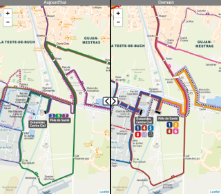
GeoCompare is a Transdev tool, which allows you to compare at a glance, in a very educational and accessible way, 2 networks: the current network and the proposed network!